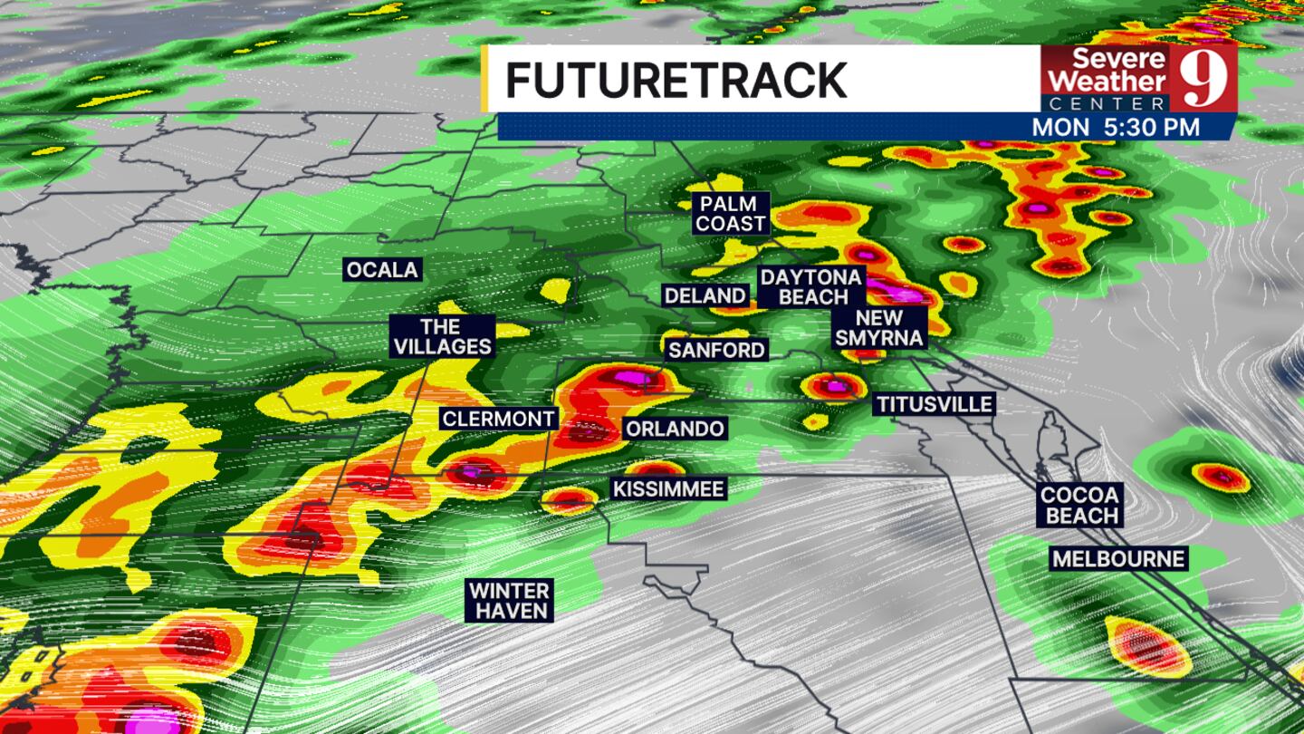
ORLANDO, Fla. — A Weather Alert Day has been issued due to an increasing risk of severe weather Monday afternoon.
Strong winds up to 60 mph, small hail and isolated tornadoes will be the biggest impacts felt in our area.
The cause of the storms will be slightly different from what we had on Sunday.
On Sunday, we saw these thunderstorms develop from a front that was stalled just to our south and warm and humid air.
On Monday, we are tracking a cleanup front moving in from the panhandle that will take advantage of some of the leftover energy and could produce strong winds and thunderstorms.
The timing will be a little different from yesterday as well. Our best chance to see the strongest storms will be between 2 p.m. and 5 p.m.
During the evening the front will continue to move towards the south and our rain chances will decrease before dry air takes over the rest of the week.
We will also see a pretty significant cooldown tomorrow. Afternoon high temperatures will struggle to stay over 60 degrees throughout most of our area.
This will be short-lived because we will be back in the 70s by Wednesday.
We are not tracking any other good chance of rain over the next week.
Click here to download our free news, weather and smart TV apps. And click here to stream Channel 9 Eyewitness News live.

©2026 Cox Media Group