CENTRAL FLORIDA — We have weather on the way for Central Florida due to strong winds and potential for severe weather on Sunday.
After a fantastic Valentine’s Day with high temperatures in the upper 70s, we will be tracking a strong cold front that will increase the winds in our area early Sunday afternoon.
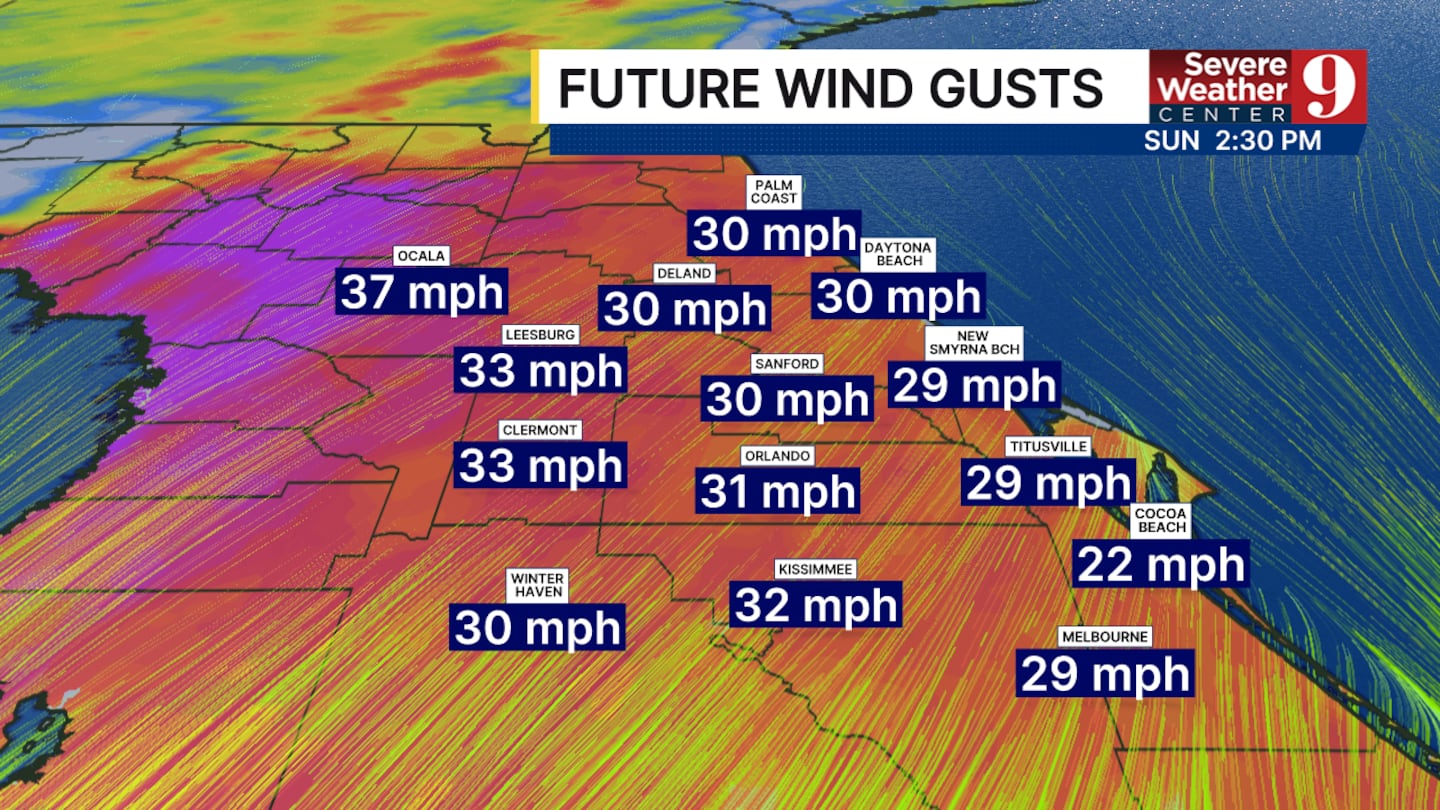
Everyone could see wind gusts between 30 and 40 mph at some point during the afternoon. As the front approaches and thunderstorms develop, we may even see gusts up to 50 mph in isolated areas.
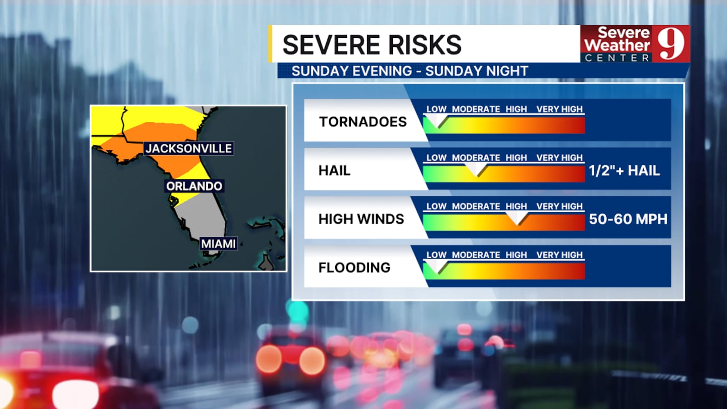
The rain will be moving steadily across the state, creating more widespread severe weather in the panhandle and North Florida.
As the front continues south there will be less available energy to produce severe storms however these cannot be ruled out for Central Florida.
The wind is the main threat from the storms, as previously mentioned, but in the strongest storms, hail up to half an inch in diameter will be a secondary threat.
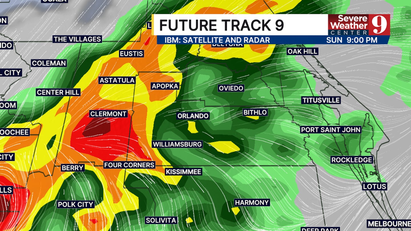
The window for the storms to move through Orlando will be from mid-evening until 10:00 p.m., after which the system will continue south and lose steam.
We will be much clearer and slightly cooler for President’s Day with highs in the lower 70s. We will quickly return to the 80s by Wednesday.
We are not tracking another good chance of rain over the next 10 days, once we are done with this system on Sunday.
Click here to download our free news, weather and smart TV apps. And click here to stream Channel 9 Eyewitness News live.

©2026 Cox Media Group