

ORLANDO, Fla. — Tropical Storm Isaias strengthened Wednesday morning and is expected to intensify rapidly as it moves toward the northern Gulf Coast.
Maximum sustained winds reached 45 mph, according to Channel 9 meteorologist Kassandra Crimi. The storm is expected to become a hurricane.
The National Hurricane Center forecast rapid strengthening over the next couple of days in its early Wednesday advisory.
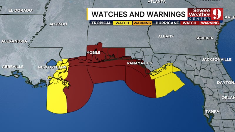
The storm’s center is not currently forecast to head toward Central Florida, but portions of the Florida Panhandle could face significant impacts.
Crimi said hurricane and storm surge watches have been issued along portions of the northern Gulf Coast, from Louisiana to the Florida Panhandle.
High winds, storm surge and heavy rain could affect the region beginning Friday. Residents in those areas should closely follow forecast updates as the storm develops.
In Central Florida, fast-moving showers and isolated storms are possible Friday and Saturday.

Channel 9 meteorologists will also monitor the potential for isolated tornadoes. Rain is expected to be more scattered than the widespread showers and storms the area has experienced over the past several days.
The forecast will continue to change as Isaias strengthens. Follow Channel 9 for updates on the storm’s track and potential local impacts.
Click here to download our free news, weather and smart TV apps. And click here to stream Channel 9 Eyewitness News live.

©2026 Cox Media Group